Educational Product
Type of resources
Keywords
Publication year
Scale
Topics
-
This document contains a summary of and links to Geoscience Australia's resources appropriate for the teaching of Year 4, 6, 8 and 9 Earth and Space Science.
-
5 educational posters created for the Sapphire Coast Marine Discovery Centre in Eden on Geomorphology, Geology, Land Use and Type, and Seabed Habitats.
-
No abstract available
-
Onshore Energy and Minerals Division Open Day Word Game Find the hidden answer to the question following: What are OEMD looking for? 1. What does 'O' in OEMD stand for? 2. What is one type of scientist that works at GA? 3. What type of energy comes from hot rocks? 4. What are the oldest rocks on the Australian continent? 5. Name one type of mineral ore found in Australia 6. What is one type of uranium system? (___________ Uranium.) 7. What does the 'm' in AEM stand for? 8. What type of electronic positioning device does a geologist use in the field? 9. Name a type of ore from WA? (______ Ore) 10. Name a tool that looks a bit like a hammer that a geologist uses in the field? 11. What energy resources can Radiometrics be used to map? 12. The Gravity Anomaly Map covers all of 13. What GIS tool is available on the GA website? 14. Vibrations are used in what kind of geo-scientific survey?
-
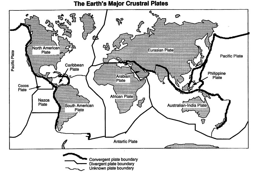
The Plate Tectonics education resource comprises; <li>56 page booklet including the concepts behind plate tectonics, the internal structure of Earth, three types of plate boundaries, evidence in support of plate tectonics such as palaeomagnetism, and examples of plate tectonics' importance</li> <li>5 reproducible student activities</li> <li>suggested answers</li> The booklet reviews the nature of Earth's outer layers and how they interact to create moving continents, mountains, volcanoes and earthquakes. Activities cover key concepts of plate tectonic theory. Suitable for secondary level Years 7-12
-
This bulk set comprises 10 sets of 5 image cards. The cards are the same as the single set of cards included in both the Discovering Remote Sensing kit and each student manual in the Discovering Remote Sensing bulk set (purchased separately). The image cards are used with the student activitities in each of the latter two Remote Sensing resources. Suitable for secondary years 8-12
-
Australia's Maritime Jurisdiction themed addition to GAV placemat series commissioned by Communications & Governance Section for educational purposes. Not for sale or general release.
-
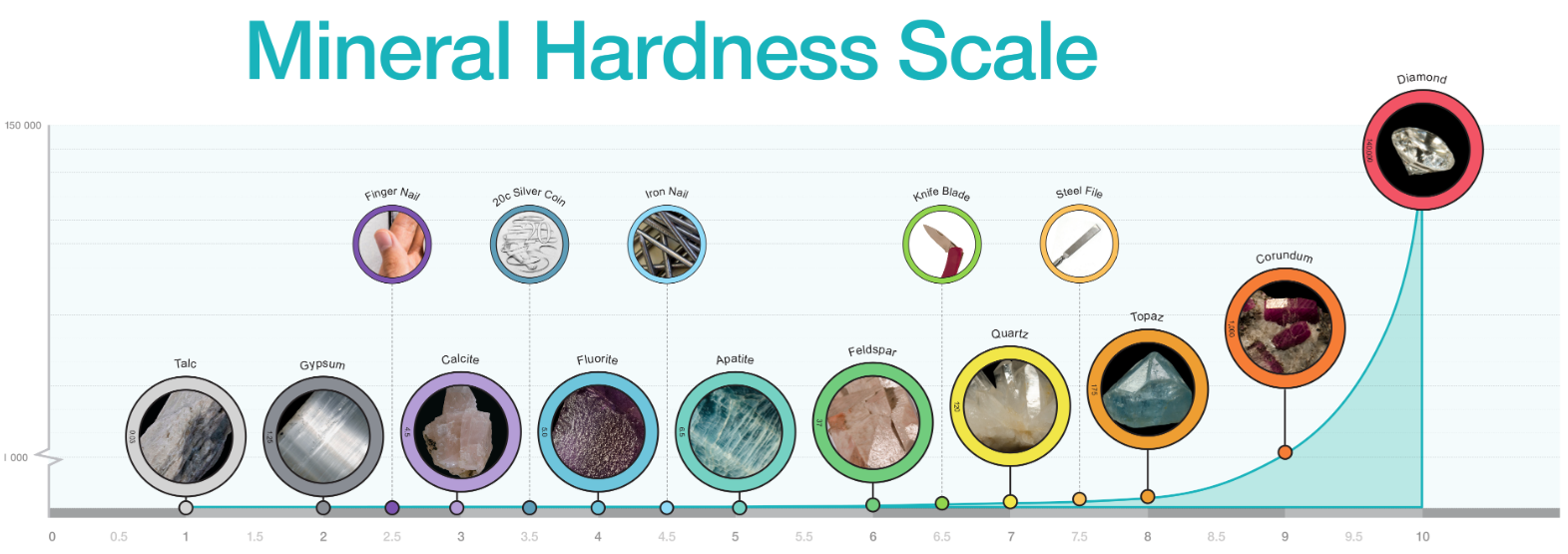
Diagram of mineral hardness comparing Mohs relational scale and Rosiwal absolute hardness. Includes photographs of specimens for each number on Mohs Hardness Scale. Best printed in colour at A3 or larger.
-
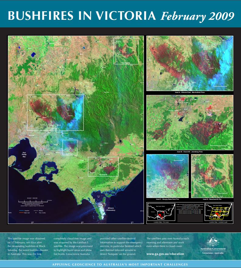
The main part of this spliced satellite image was obtained on 17 February, ten days after the devastating bushfires of Black Saturday. This was the first cloud-acceptable image of the fires and was acquired by the Landsat-5 satellite. Close-ups of Kilmore East-Murrindindi, CHurchill-Teeralang, Bunyip State Forest fire and Beecworth included. The raw image was processed to highlight burnt areas (dark red) and show fire fronts. Vegetation appears green and the smoke appears pale blue.
-
This bulk set contains fifteen special double-sided 1:75 000 Mount Todd maps, with topography on one side and geology on the other side. Also included are fifteen 1: 75 000 transparent plastic map-reading cards. This area of the Northern Territory contains part of Nitmiluk National Park (Katherine Gorge) and includes sedimentary, igneous and metamorphic rock types and also interesting geological features such as faults, folds and granite intrusions. Suitable for use at secondary level Years 8-12.